
PATAGONIA · CHILE
Where the landscape imposes silence, and deep gaze
The Strait of Magellan and the ice fields impose a scale that redefines the group's presence. Torres del Paine offers tracking and sighting of pumas in their natural habitat, herds of guanacos, and condors flying over the steppe, along with guides specialized in tracking them.
We design private navigation through unexplored fjords, Patagonian estancias with exclusive access, and encounters with local communities far off the conventional circuit.
PUNTA ARENAS · PATAGONIA · CHILE
Southern wildlife in its habitat
Punta Arenas is the gateway to the southern tip of the continent and the starting point for discovering Chilean Patagonia.
Its history tied to great navigators, its heritage architecture, and its privileged location on the shores of the Strait of Magellan give it a unique identity.
From here it is possible to experience some of the most extraordinary wildlife encounters in the region. Colonies of Magellanic and king penguins, whale watching during the season, and navigation through the Strait of Magellan allow visitors to discover a practically untouched ecosystem, accompanied by specialized guides.
Here, wildlife isn't searched for: it's found, because the itinerary is designed around their behavior, not on chance.
TORRES DEL PAINE · PATAGONIA · CHILE
The journey as an expedition
One of the national parks with the most iconic landscapes in Chilean Patagonia and one of the most spectacular nature destinations on the planet.
Its granite mountains, turquoise lakes, glaciers, and vast steppes create a scenery that surprises at every turn.
LAGOS · PATAGONIA · CHILE
The Andean Crossing: The Lakes Region
There are itineraries that function like a story: a beginning, a development, and an ending that changes the perspective. The route asks for its time. That is what makes it valuable in a corporate context: it forces one to stop.
The journey links the Todos los Santos, Frías, and Nahuel Huapi lakes, combining navigation and overland sections among forests, volcanoes, and mountain passes. It is carried out in both directions—from Chile to Argentina or from Argentina to Chile—and the choice of direction defines the character of the journey: to the west, the itinerary ends facing the Pacific; to the east, it concludes in the Andean steppe.
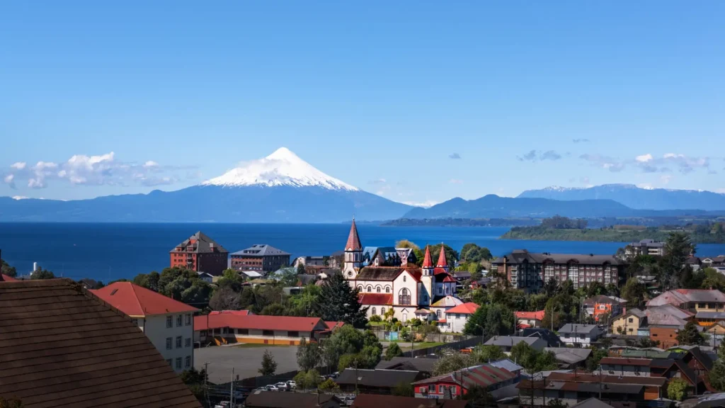
— PUERTO VARAS
Base on Llanquihue
On the shores of Chile's second largest lake, with the Osorno and Calbuco volcanoes on the horizon. German colonial architecture, world-class hospitality, and a city scale that allows you to walk all of it. It is the point where the Andean crossing begins—or ends.
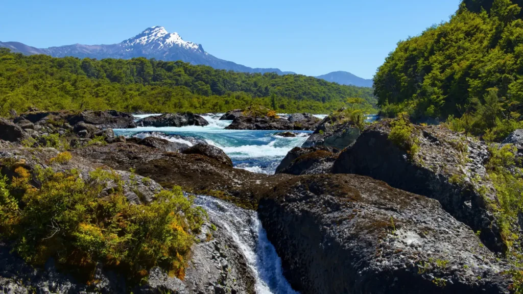
— Petrohué
The heart of the route
The Petrohué River rapids, the deep green water, and the boat trip beneath the silhouette of the Osorno volcano. The most scenic section of the crossing and the one that defines the lasting image of the journey.
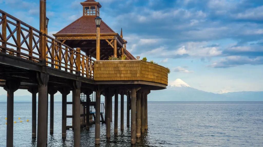
— FRUTILLAR
German architecture on the shores of Llanquihue
On the shores of Lake Llanquihue, with the Osorno volcano in the background, Frutillar combines German colonial architecture and world-class musical culture. Its summer classical music festival and a gastronomy that brings together the sea and land of southern Chile complete the scene. After the intensity of the Patagonian route, Frutillar acts as an active pause: walking, sitting by the lake, and chatting without an agenda.
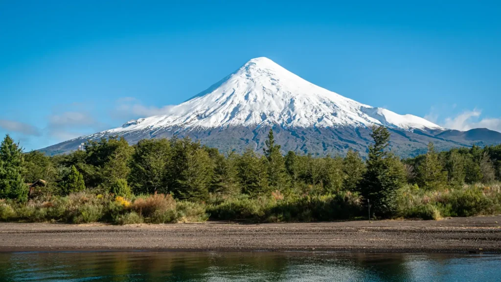
— Puerto Montt
Gateway to the Deep South
Port city with direct access to Chiloé, its World Heritage wooden churches, and curanto cooked underground on hot stones. Nearby, the trails of Vicente Pérez Rosales National Park climb toward the Osorno volcano, and the lakes and channels open the terrain to kayaking and sailing. The itinerary can continue south or end here.
SOUTHERN NAVIGATION
Punta Arenas · Patagonian Channels · Ushuaia
There are places that can only be understood from the water. The southern channels connecting Punta Arenas to Ushuaia are one of them: a labyrinth of fjords, glaciers that plunge directly into the sea, uninhabited islands, and wildlife that has not learned to fear human beings.
The navigation lasts between four and five days depending on the chosen direction, with Zodiac landings at the foot of the glacier, penguin colonies, and viewpoints overlooking the Beagle Channel.
The journey maintains small groups and direct access to the territory: itineraries that adapt to the daily weather conditions, and specialists in southern history and ecology who lead the interpretation of the landscape on board. Each leg becomes a guided immersion into a territory that demands interpretation.
— Punta Arenas: starting point
The city has its own identity: constant wind, end-of-the-world architecture, and a hospitality inherited from travelers and seal hunters.
Rixner adds city time with a curatorial criterion — local gastronomy, historical heritage, ranches of the Magellanic Tierra del Fuego — before embarking toward the channels.
— Ushuaia: the end that reorients
Arriving in Ushuaia after days of navigating the channels changes one's perception: the southernmost city in the world feels, paradoxically, welcoming. The Beagle Channel, Tierra del Fuego National Park, and the history of the Yagan people take on another dimension when arriving by water.
Let's talk about the itinerary.
Meetings, incentives, conferences, and exhibitions
One destination, one encounter: Patagonia